Destination
Spanstinden – 1,457 m
A day hike to the highest summit in Lavangen
1,457 m · Lavangen · Northern Norway
One of the finest day hikes in the area leads to the summit of Spanstinden at 1,457 metres. Along the way you pass streams, waterfalls, rocky ground, open mountain terrain and, in summer, sheep grazing on the slopes.
At the top the long climb is rewarded with views over the Lavangen fjord – and on a clear day you can even pick out Villa Sjøsiden far below by the water.
- 1,457 m
- Summit
- ~7 km
- Each way
- ~1,000 m
- Ascent
- 5–8 h
- Time
The trailhead is by the E6 road, at around 500 metres.
Heading for Spanstinden
In snow-free conditions the summit is reached along a marked trail. The trailhead sits by the E6 road at about 500 metres, so there is close to 1,000 metres of climbing to the top.
The route is roughly seven kilometres each way. Allow 5–8 hours for the whole hike depending on your fitness, breaks and conditions.
The path mostly follows the southern side of Spanstinden, so on a sunny day the sun stays with you for much of the way.
Show the trailhead on the map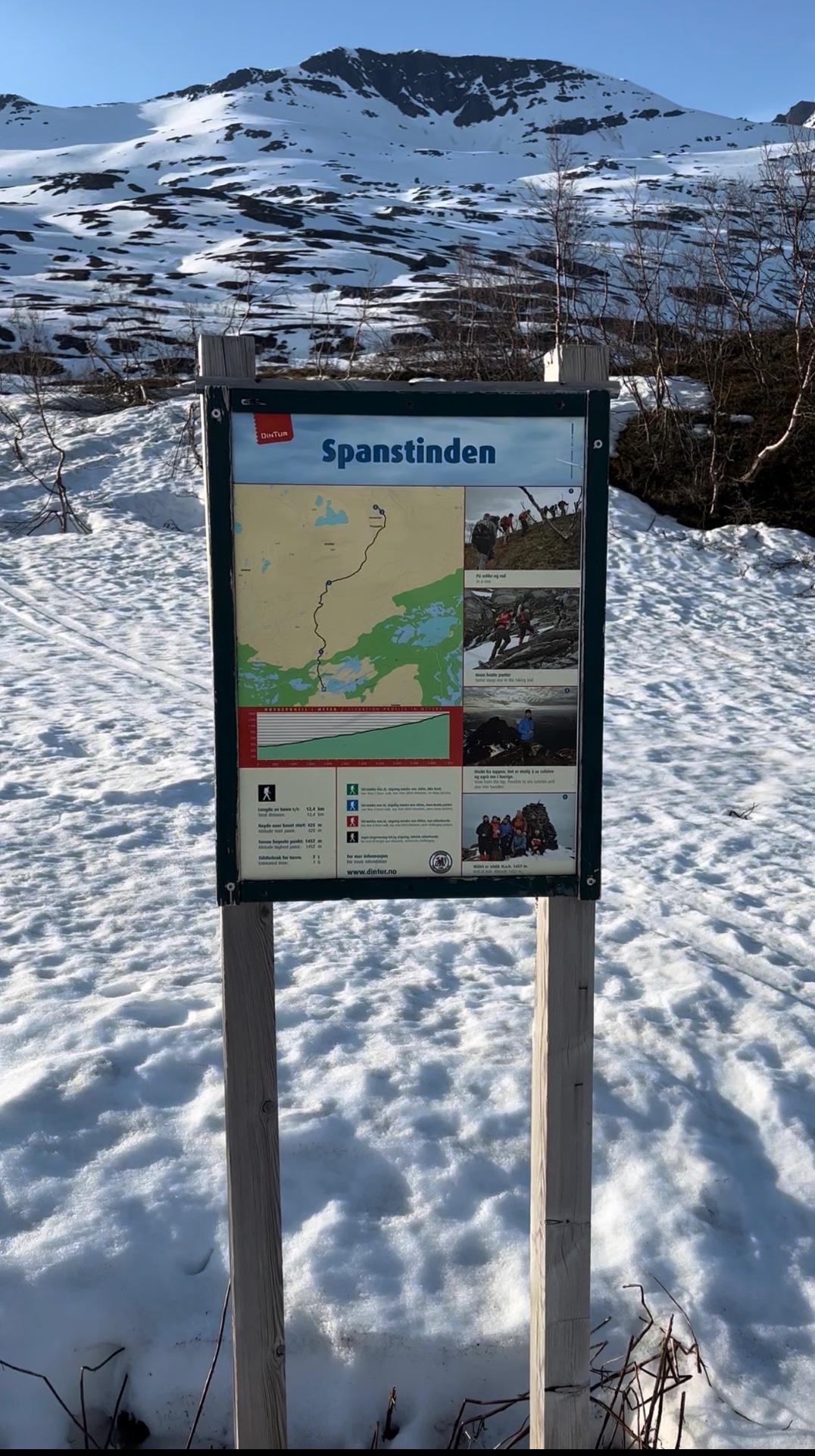
The trail keeps changing
The climb is not the same all the way. Some stretches are easy walking, others bring steeper ground, rocks and wetter sections.
After rainy days the trail can be very wet and muddy. In early summer, and again in autumn, you may meet snow higher up.
The route is marked, but in the mountains keeping track of your own route and reading the conditions is always part of the hike.
No need to rush to the top
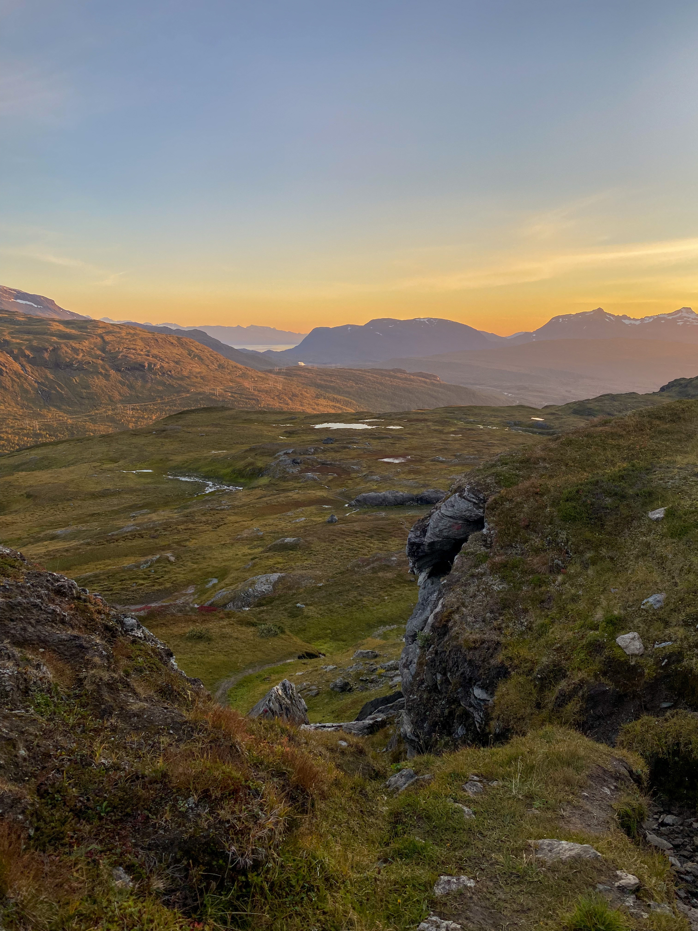
The best of Spanstinden is not only the summit. The landscape keeps changing, and you pass streams, small waterfalls and open mountain scenery.
In summer sheep graze on the mountain, so you will often meet them along the way.
Long before the summit there are places where it is worth stopping for a moment and simply looking around.
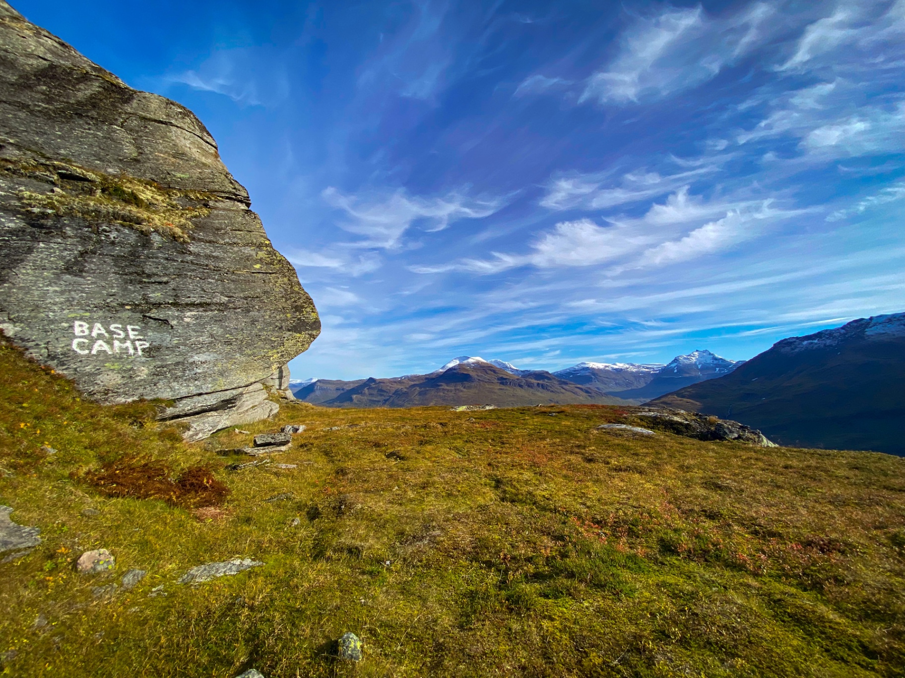
The first proper break – Base Camp
For the first longer break I recommend the spot I call Base Camp.
By this point you have enough climbing behind you that a rest and some food taste good. Take a moment for the view as well – you have gained real height and the fjord starts to open up below.
Nature's own swimming pool
A little above Base Camp comes one of the fun details of the route – nature's own small “swimming pool”.
It is mountain water, so do not expect anything like a heated pool. The bravest still take a refreshing dip before carrying on up.
Towards the summit
The higher you climb, the more open the landscape becomes. At the same time wind and temperature can change quickly.
Even if it is warm and calm at the trailhead, the weather on the summit can be completely different. Pack warm clothing even on a good day.
Check the wind before you set out. If it is blowing hard up top or the weather turns, the summit can easily wait for another day. There is plenty to see along the route itself.
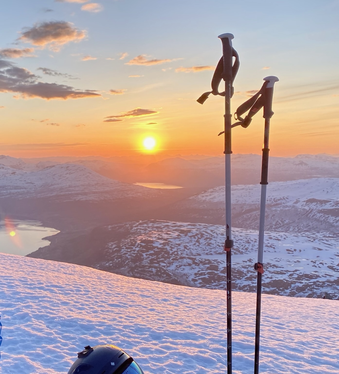
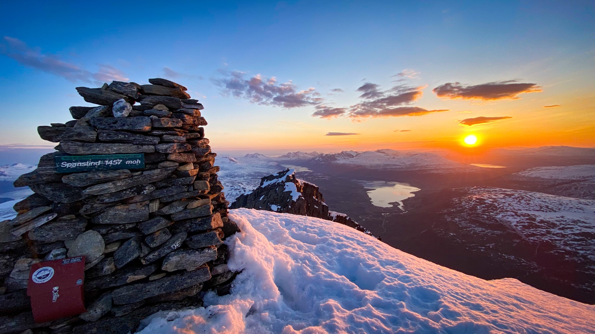
1,457 metres – the long climb is behind you
Up here the views make up for the effort.
From the summit you look towards Tennevoll and out over the Lavangen fjord. On a clear day you can also make out Villa Sjøsiden far below by the water.
In clear weather the view carries a very long way across the surrounding mountains.
Don't turn straight back at the top. Take time for the view, eat your food and enjoy the fact that the long climb is done.
Coffee at 1,457 metres
If conditions are right and the wind stays reasonable, a warm coffee or hot chocolate tastes especially good up here.
Bring your own thermos – there is no hiking flask at the cabin to take along.
The summit book
And before you head back down, look for the mailbox at the top. Inside you'll find the summit book – remember to leave your name.
Good to know before you go
Spanstinden is a long mountain hike, so take your gear and the conditions seriously. Check the weather, and especially the wind on the summit, before you leave.
Bring enough to drink, food, warm clothing and footwear suited to mountain terrain. Mountain weather can change fast.
There are streams and waterfalls along the route, but I cannot promise that the natural water is safe to drink.
Always match the hike to your own experience, fitness and the conditions on the day.
Trailhead
The trailhead is by the E6 road at around 500 metres. From there it is close to 1,000 metres of climbing to the summit.
- E6 / Gratangsfjellet
- Lavangen
- About 7 km each way
How the hike unfolds
- Start by the E6 road
- The trail: easy path, rocks and wet sections
- Base Camp – the first proper break
- Nature's own swimming pool
- Upper slopes – the wind can pick up
- Summit at 1,457 m
- Summit book in the mailbox
Into the mountains of Lavangen
Spanstinden is the highest mountain in Lavangen. Villa Sjøsiden sits down by the fjord, a short drive from the mountains around it.